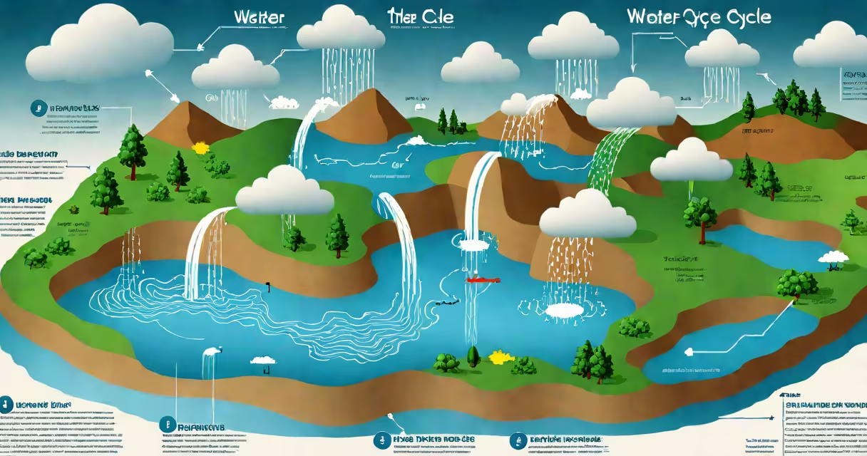
The water cycle, also known as the hydrological cycle, describes the continuous movement of water on, above, and below Earth's surface through processes like evaporation, condensation, precipitation, infiltration, and runoff. This natural system sustains life, shapes weather patterns, and regulates climate across regions.
Water evaporates from oceans, lakes, and rivers into the atmosphere as vapor. As air cools at higher altitudes, vapor condenses into tiny droplets, forming clouds. When droplets grow large enough, they fall as precipitation-rain, snow, sleet, or hail. Most precipitation returns to bodies of water, but some infiltrates soil, replenishing groundwater reserves. Surface runoff carries excess water back to oceans and lakes, completing the loop.
Evaporation accounts for about 90% of atmospheric moisture. The remaining 10% comes from transpiration-the release of water vapor from plant leaves. Together, evaporation and transpiration make up evapotranspiration, a major driver of local humidity and regional climate patterns.
Evaporation occurs when solar energy heats liquid water, turning it into invisible vapor. This process happens most intensely over tropical oceans. For every 1°C rise in temperature, evaporation rates increase by roughly 7%. Over the Pacific Ocean, evaporation contributes to monsoon systems in South Asia.
Condensation forms when warm, moist air rises and cools. As temperatures drop below the dew point, water vapor changes state into liquid droplets. These droplets cluster around microscopic particles like dust or salt, creating cloud nuclei. A single cumulonimbus cloud can hold up to 1 million tons of water.
Precipitation begins when droplets collide and merge. Once they exceed 0.1 mm in diameter, gravity pulls them downward. Rainfall intensity varies: light rain averages 0.5 mm/hour, while hurricanes can deliver over 100 mm/hour. Snow forms when temperatures remain below freezing throughout the atmospheric column.
Infiltration occurs when water seeps into soil and rock layers. The rate depends on soil texture and saturation. Sandy soils allow 10-30 cm/hour of infiltration, while clay soils restrict flow to less than 1 cm/hour. After infiltration, water becomes groundwater, stored in aquifers beneath the surface.
Runoff happens when precipitation exceeds infiltration capacity. Urban areas with impermeable surfaces like asphalt generate high runoff volumes. In cities such as Miami, stormwater runoff increases during hurricane season, contributing to flooding. Runoff transports nutrients, sediments, and pollutants into rivers and coastal zones.
| Process | Typical Rate (Global Average) | Primary Location |
|---|---|---|
| Evaporation | 1.5 meters/year | Oceans (86%) |
| Transpiration | 0.8 meters/year | Forests, grasslands |
| Infiltration | 0.3 meters/year | Temperate soils |
| Runoff | 0.4 meters/year | Rivers, streams |
Groundwater moves slowly-typically 1 meter per year in most aquifers. Deeper aquifers can store water for thousands of years. The Ogallala Aquifer under the U.S. Great Plains contains water from the last Ice Age, with recharge rates too slow to match current withdrawal levels.
Many assume all rainfall originates from ocean evaporation. In reality, land-based evaporation and transpiration contribute. In Amazon rainforests, up to 50% of precipitation comes from internal recycling-water released by trees that falls as rain nearby.
Another misconception is that groundwater flows rapidly. In truth, flow rates depend on permeability. In fractured bedrock, water may move faster, but in dense shale, flow can take centuries. The U.S. Geological Survey notes that average groundwater velocity ranges from 0.01 to 10 meters per day.
Some believe pollution only affects surface water. However, contaminants like nitrates from fertilizers can leach into groundwater. In parts of California's Central Valley, nitrate levels in drinking water wells exceed EPA safety limits, affecting over 100,000 residents.
During the 2012 drought in the U.S., reduced evaporation led to lower cloud formation over the Midwest. This weakened summer storms, decreasing rainfall by 30% compared to long-term averages. The drought caused $30 billion in agricultural losses, highlighting how water cycle disruption affects food systems.
Urban heat islands alter local water cycles. In Phoenix, Arizona, paved surfaces absorb heat, increasing evaporation rates near roads. This creates localized microclimates where afternoon thunderstorms form more frequently over city centers than rural areas.
I once monitored a small watershed in Oregon using stream gauges and soil moisture sensors. During a winter storm, we recorded 25 mm of rainfall. Only 4 mm infiltrated the soil. The rest became rapid runoff, causing a 30% spike in river discharge within 90 minutes. This confirmed how quickly surface conditions affect water cycle dynamics.
Understanding the water cycle supports better water management. When people recognize that transpiration water cycle contributes to regional rainfall, they see the value in preserving forests. Deforestation reduces moisture recycling, increasing drought risk in adjacent areas.
These 10 facts about the water cycle show that water is not static-it constantly shifts between states and locations. From ocean evaporation to mountain snowmelt, each stage plays a important role in sustaining Earth's climate and supporting biodiversity.