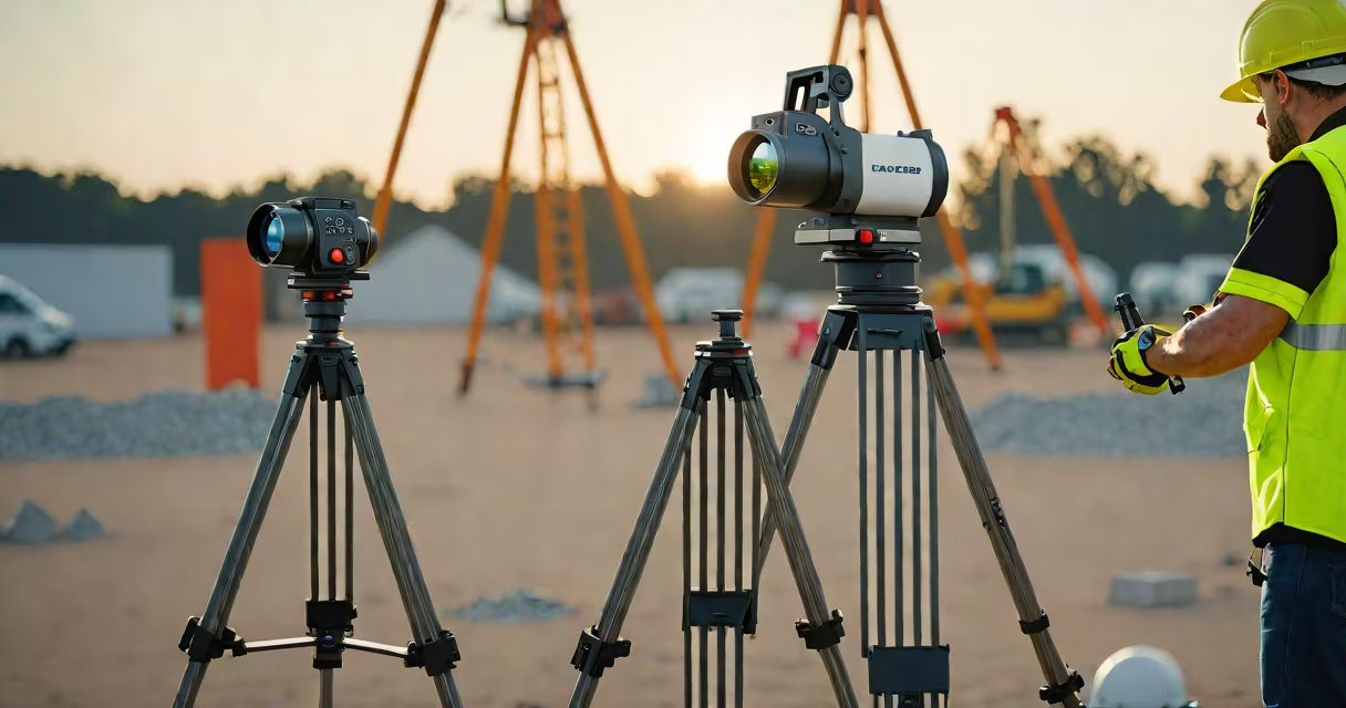
Lidar surveying uses pulsed laser light to measure distances and generate high-resolution 3D models of surfaces, terrain, and objects. It captures millions of data points per second, enabling accurate spatial analysis for engineering, environmental monitoring, and urban planning.
Lidar stands for Light Detection and Ranging. Unlike radar, which uses radio waves, lidar emits laser pulses-typically in the near-infrared spectrum-and measures the time it takes for each pulse to return after reflecting off a surface. This time-of-flight calculation determines distance with millimeter precision. The resulting dataset, called a point cloud, forms a digital representation of physical environments.
The technology originated in the 1960s but became widely accessible in the 2000s due to advancements in GPS integration, motion sensors, and processing power. Today, lidar surveying is standard in fields requiring sub-centimeter accuracy, such as autonomous vehicle navigation, archaeological site documentation, and flood modeling.
A lidar system consists of a laser emitter, a scanner, a photodetector, and a timing circuit. Most systems integrate with GPS and inertial measurement units (IMUs) to track position and orientation during data collection. As the sensor moves-mounted on aircraft, drones, vehicles, or stationary tripods-it fires thousands of laser pulses per second.
Each pulse reflects off surfaces and returns to the sensor. The system calculates the round-trip time and converts it into a distance. By combining this distance with the sensor's known location and angle, the system assigns a 3D coordinate (x, y, z) to each reflection. Over time, these coordinates form a dense point cloud.
For example, a drone flying at 100 meters above a forest canopy emits 100,000 pulses per second. Some pulses hit tree branches, others pass through gaps and reflect off the ground. The system records both reflections, allowing software to distinguish between canopy height and terrain elevation-a capability critical for forest biomass estimation.
Lidar surveying systems fall into two main categories based on platform and scanning method:
| Type | Platform | Scan Method | Typical Use Case | Accuracy Range |
|---|---|---|---|---|
| Terrestrial | Ground-based (tripod-mounted) | Rotating mirror or prism | Building façade scans, bridge inspections | ±2 mm to ±5 mm |
| Aerial | Mounted on aircraft or drones | Forward-looking or side-scan | Topographic mapping, landslide detection | ±1 cm to ±5 cm |
| Mobile | Vehicle-mounted | Rotating or oscillating scanner | Roadway profiling, utility corridor surveys | ±1 cm to ±3 cm |
Terrestrial lidar offers the highest resolution for static scenes. A single scan from a tripod-mounted unit can capture over 1 million points per second. Mobile lidar systems, often used in highway maintenance, collect data while moving at speeds up to 60 km/h. Aerial lidar, especially when flown at low altitudes, achieves vertical accuracy within 10 cm-critical for floodplain delineation.
One non-obvious distinction: not all lidar systems detect intensity. Intensity values represent how much energy a pulse reflects back. This feature helps differentiate materials-concrete reflects more than vegetation-but many consumer-grade devices omit intensity data to reduce processing load.
Lidar surveying enables projects that were previously impractical or too slow using traditional surveying tools like total stations or photogrammetry.
In civil engineering, lidar supports infrastructure design. For instance, the California Department of Transportation used aerial lidar to assess road subsidence along Highway 1 near Big Sur. The data revealed a 15 cm drop in elevation over 2 kilometers-information that guided emergency reinforcement efforts before a landslide risk increased.
Environmental scientists use lidar to monitor coastal erosion. A 2021 study published in *Remote Sensing of Environment* analyzed lidar surveys of the Louisiana coastline between 2010 and 2020. Researchers found that wetland loss accelerated from 1.2 km²/year to 3.7 km²/year, with lidar detecting subtle changes below the resolution of satellite imagery.
Urban planners rely on lidar for city modeling. The City of Toronto deployed mobile lidar across 120 km of streets to update its digital twin. The system captured curb heights, sidewalk slopes, and utility poles with 95% accuracy, enabling better accessibility planning under the Accessibility for Ontarians with Disabilities Act (AODA).
Lidar surveying is often mistaken for photogrammetry, which uses overlapping images to reconstruct 3D geometry. While both produce 3D models, lidar measures actual distance via laser timing, whereas photogrammetry infers depth from image perspective shifts.
Photogrammetry struggles in low-light conditions or with reflective surfaces-glass buildings, water bodies, or shiny metal. Lidar handles these scenarios reliably because lasers penetrate fog and reflect consistently across materials. A 2020 comparison by the U.S. Geological Survey showed lidar achieved 98% classification accuracy in dense urban areas, compared to 84% for photogrammetry.
Another common confusion: lidar versus radar. Radar uses radio waves and operates effectively in rain, snow, and fog. Lidar is sensitive to atmospheric interference-dense fog can scatter laser pulses and degrade data quality. However, lidar provides far higher resolution than radar, making it ideal for detailed terrain modeling.
I once used a handheld terrestrial lidar scanner to document a historic church in rural Vermont. The structure had uneven masonry and weathered stonework. Traditional measurements took two days and yielded inconsistent results. With lidar, we completed the scan in 90 minutes and generated a model accurate to ±3 mm. The data revealed structural shifts undetectable by eye or tape measure.
Lidar surveying requires careful planning. Weather conditions affect performance-rain reduces signal strength, and heavy snow can obscure targets. Flight paths for aerial surveys must avoid obstacles and maintain consistent altitude to prevent distortion.
Data volume is another challenge. A single hour of aerial lidar can generate 1 terabyte of raw point cloud data. Processing this data demands useful computers and specialized software like CloudCompare or Leica Cyclone. Filtering noise and classifying points (e.g., ground vs. vegetation) takes significant time and expertise.
Despite these hurdles, lidar remains unmatched for precision. According to the National Institute of Standards and Technology (NIST), lidar systems achieve sub-millimeter repeatability under controlled conditions-far exceeding manual surveying methods.